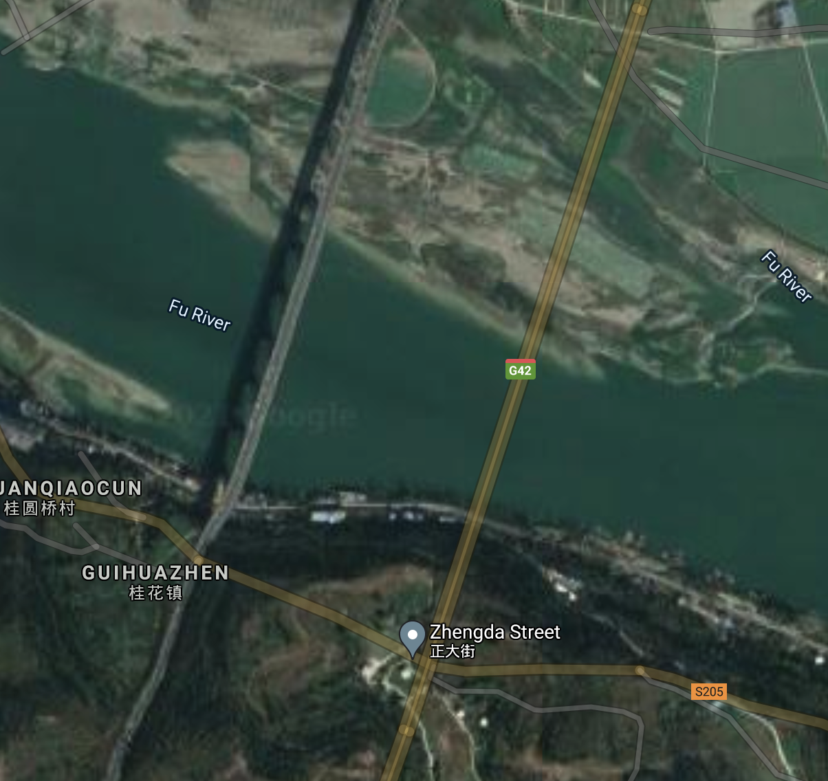
China uses a geodetic datum which provides obfuscation by adding 100-700m offsets on points. So all the google map features in china are offset randomly from reality. You can see that here where the bridge map road feature is offset from the satellite imagery. This is corrected in china's version of google maps.

GCJ-02 (colloquially Mars Coordinates, officially Chinese: 地形图非线性保密处理算法; lit. 'Topographic map non-linear confidentiality algorithm') is a geodetic datum formulated by the Chinese State Bureau of Surveying and Mapping (Chinese: 国测局; pinyin: guó-cè-jú), and based on WGS-84. It uses an obfuscation algorithm which adds apparently random offsets to both the latitude and longitude, with the alleged goal of improving national security. There is a license fee associated with using this mandatory algorithm in China
Baidu further obfuscates their geospatial data using the BD-09 datum
BD-09 is a geographic coordinate system used by Baidu Maps adding further obfuscation to GCJ-02 "to better protect users' privacy"Baidu provides an API call to convert from Google or GPS (WGS-84), GCJ-02, BD-09, MapBa or 51ditu coordinates into Baidu or GCJ-02 coordinates. As required by local law there is no API to convert into WGS-84, but open source implementations in R and various other language exist.